The Best Hiking Trails in Edmonton for All Skill Levels Year-Round

Hiking is my favourite way to shake off the week’s stress and reconnect with nature. Whether it’s clambering over rocky paths or simply soaking in the quiet of the trees, each trail offers its own sense of calm and escape from the day-to-day.
But finding the right trail can be tricky. Some are too crowded, too easy, or just too far.
If you’re looking for a trail that offers a mix of challenge and scenery, I got you covered. Check out my picks for the best hiking trails in Edmonton!
Best Easy Hiking Trails in Edmonton
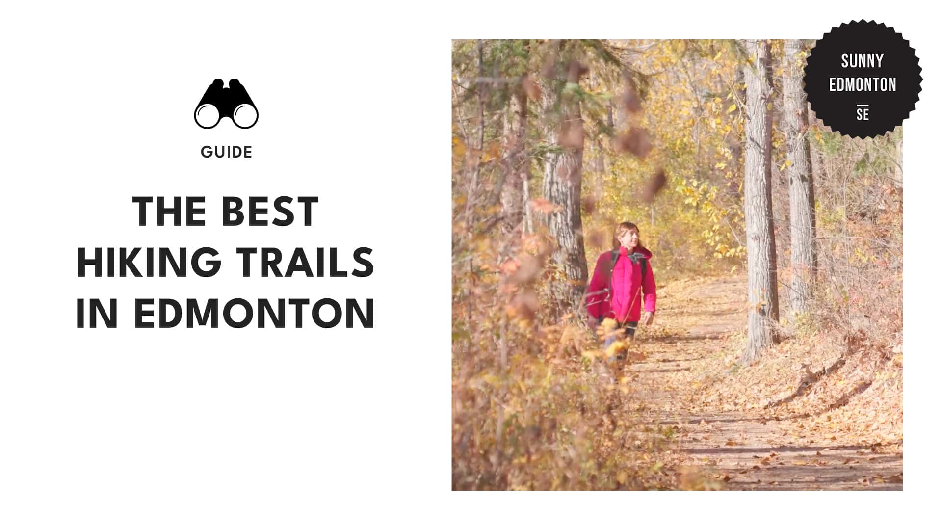
Mill Creek Ravine Trail
Starting/End Point: 34 Ave. NW
Distance: 3.5 km
Elevation Gain: 81 m
Terrain: Mixed; half on paved city paths along residential buildings, transitioning into natural paths with trees, creeks, and bridges
Mill Creek Ravine is an easy and peaceful hike, blending paved paths with natural trails. The route takes you through tree-lined sections, over small creeks, and across bridges, offering a calm escape.
It’s easy to find parking, and there are portable toilets placed around the area. You’ll also find off-leash zones, which are ideal for a peaceful walk with your dog.
I’ve enjoyed spending about 50 minutes hiking this trail, especially in the quieter areas where it feels more secluded.
| Pro Tip: If you have a dog in need of more exercise, head south on 50 St to Jackie Parker Park, where you’ll discover an off-leash area and extra trails for plenty of exploration. |
Whitemud Creek Trail
Starting/End Point: Corner of Rainbow Valley Rd NW & 45th Ave NW
Distance: 6.8 km
Elevation Gain: 137 m
Terrain: Moderately flat, with some inclines; a mix of gravel, dirt paths, and partially paved sections
Whitemud Creek Trail is a popular spot for birdwatching, hiking, and snowshoeing, with well-maintained paths that wind through a serene ravine. The old-growth forest and river views create a tranquil escape from the busy city.
I’ve appreciated how this trail feels like a natural retreat, with opportunities to spot wildlife like the great horned owls that nest in the area. Additionally, it’s good to know that dogs are welcome as long as they’re on a leash.
| Pro Tips: Visit early in the morning to avoid the crowds, especially on weekends. Bring bug spray during the warmer months, as mosquitoes can be quite active. Parking is available near Rainbow Valley Road, and the trail is easy to access from there. |
William Hawrelak Park Riverside Walk
Starting/End Point: William Hawrelak Park Road
Distance: 4.7 km
Elevation Gain: 70 m
Terrain: Paved paths, well-marked trails, some road crossings, and natural areas with trees and foliage
William Hawrelak Park is a great spot for a leisurely stroll that usually takes about an hour. The trail begins in the park and connects to the River Valley trail system, with well-marked paved paths leading you toward Emily Murphy Park.
As you walk, you’ll enjoy a mix of tree-covered sections and occasional river views, making for a peaceful outing. You’ll encounter a gentle elevation change on your return, leading you past picnic areas and the lake back to the starting point.
| Pro Tips: Use parking at picnic site #2 for convenient access to various trails in the river valley system. Stay alert for traffic while navigating the roads, as they are shared by walkers and bikers. |
Riverlot 56 Loop
Starting/End Point: Riverlot 56 Upper Trailhead
End Point: P
Distance: 6.6 km
Elevation Gain: 151 m
Terrain: Mostly flat with some gentle hills
The Riverlot 56 Natural Area offers a peaceful escape with a single scenic trail winding through lush greenery. This area features diverse habitats, including aspen forests and meadows.
You can enjoy a tranquil walk while taking in the sights and sounds of various bird species and wildlife, such as deer and beavers. This is especially true near the stream banks lined with willows and cattails.
In winter, the trail is track set for cross-country skiing, ensuring it remains wide enough for hikers and dogs without disrupting the ski tracks.
| Pro Tips: Always carry a bag to pick up litter, as keeping the area tidy not only enhances the beauty of Riverlot 56 but also protects wildlife from potential hazards. Avoid using mountain bikes and motorised vehicles. When hiking here, stick to walking to maintain the integrity of the natural area and ensure a safe experience for all visitors. |
Fort Edmonton Park Loop Trail
Starting/End Point: Fort Edmonton Park parking lot, near the John Janzen Nature Centre
Distance: 4.7 km
Elevation Gain: 118 m
Terrain:
- First half: Paved path
- Second half: Packed gravel path with some elevation changes
Fort Edmonton Park spans 158 acres of wooded parkland, showcasing over 80 historical buildings from different eras. As I walked along the trail, I enjoyed the unique attractions, including the historic Hotel Selkirk and the steam engine.
The first half of the trail is paved, with gentle elevation changes. Information markers along the way share interesting facts about the history and wildlife, and the new Fort Edmonton Footbridge provides stunning views of the river valley.
The second half features a packed gravel path where I strolled among the trees with the river on my left. This trail connects to White Mud Ravine, allowing for longer walks or a leisurely return to the parking lot.
| Pro Tip: Make sure to pause and read the information markers along the trail that cover the area’s history and wildlife. Doing so adds depth to your run and helps you appreciate the local culture. |
Best Moderate Hiking Trails Around Edmonton
Rundle Park Bridge Loop Trail
Starting/End Point: Rundle Park parking lot
Distance: 4.3 km
Elevation Gain: 100 m
Terrain: Hard-packed gravel paths, paved trails, with some stairs and inclines
Rundle Park is a lovely spot for outdoor activities throughout the year. With rolling hills, natural forests, and multi-use trails, it offers a peaceful environment for a variety of visitors.
The trail starts at the parking lot and leads to a riverside path surrounded by trees. You’ll then cross the first bridge to Strathcona Science Park, where you might spot various birds and butterflies.
Continuing along the trail, you’ll climb some stairs and pass under several bridges. After reaching a junction in the trail, you can make your way back to the clubhouse, enjoying the gentle descent on paved paths with lovely views of the park.
| Pro Tips: Bring binoculars for birdwatching; you might see species like Canada geese, mallards, and red-tailed hawks. |
Capilano Park Loop Trail
Starting/End Point: Capilano Park Rd NW
Distance: 4.2 km
Elevation Gain: 89 m
Terrain: Flat sections, gentle climbs, paved and gravel paths, with steep climbs and descents
Capilano Park, created in the 1960s, offers a lovely hiking experience with views of the river valley. Starting from the parking lot, the trail begins flat before climbing gently past homes, with bike paths to the right.
At the first summit, I found benches and a lookout with views of the river and downtown. The trail loops around the neighbourhood, returning to the park, where I could go left to Riverside Golf Course or right onto gravel paths.
I enjoyed the steep climbs and drops, spotting wildlife along the way and taking in the river views. The return on paved trails was quieter, leading me back to the parking lot after a satisfying moderate hike.
| Pro Tips: Arrive early to secure a spot in the small lot, especially on weekends. |
Emily Murphy Park Two Bridge Loop Trail
Starting Point: Emily Murphy Park Parking Lot
Distance: 4.8 km
Elevation Gain: 68 m
Terrain: Paved pathways, trails through trees, and pedestrian bridges
Emily Murphy Park provides a chance to explore downtown while enjoying the natural beauty of the North Saskatchewan River. The trail has easy access, with convenient parking and public restrooms available.
As I walked beneath the Dudley B. Menzies Bridge, I enjoyed views of the river valley and the high-level bridge. The paved pathways of Victoria Park are popular for both joggers and those on their lunch break.
Crossing the Groat Bridge, I appreciated the safe pedestrian access and great photo opportunities. The trail features minimal elevation changes, making it suitable for families, and I often spotted birds along the way.
| Pro Tip: To cool down after your run on hot days, check out the nearby spray park or take a dip in the Queen Elizabeth Pool. Both are great places to refresh yourself post-workout. |
Strathcona County Regional Trail
Starting Point: Strathcona Park
End Point: Fort Saskatchewan
Distance: 32.3 km
Elevation Gain: 486 m
Terrain: Paved with some railway crossings and rural views, includes strategically placed benches
The Strathcona County Regional Trail is a point-to-point trail that I always enjoy hiking near Sherwood Park. While it’s popular for cross-country skiing and biking, I’ve found that you can often find a quiet moment on the trail.
The route includes both flat and steep sections, with a few railway crossings. I like the benches along the way that offer a place to rest and enjoy the rural scenery, and there are several access points to connect to the wider regional trail system.
Dogs are welcome as long as they’re on a leash, and I’ve always found parking options nearby, making it easy to start my hike.
| Pro Tips: Visiting between April and October is ideal due to the mild weather and vibrant scenery during those months. |
Best Challenging Hikes in Edmonton for Experienced Hikers
Rundle Park River Trail
Starting/End Point: Rundle Park Disc Golf Course
Distance: 20.4 km
Elevation Gain: 440 m
Terrain: Mixed (partially paved and gravel)
Beginning from Rundle Park, the riverfront trail stretches north along the west bank of the North Saskatchewan River. The combination of paved and gravel paths offers beautiful views of the river valley.
Unlike the Bridge Loop Trail, which offers easier terrain and shorter distances, this trail can be challenging due to its varied terrain and longer distance. Because of that, it’s better suited for experienced hikers.
This trail showcases diverse landscapes, including beaches, forests, and wildflowers, while also providing opportunities for birding and paddle sports.
| Pro Tips: Wear sturdy shoes, as some sections of the trail involve elevation changes and may be uneven. If you’re feeling adventurous, rent a kayak or canoe to paddle on the North Saskatchewan River for a different view of the scenic landscape. |
Tawayik Lake Trail
Starting/End Point: Tawayik Lake picnic site
Distance: 15.4 km
Elevation Gain: 213 m
Terrain: Rolling hills, meadows, and shallow valleys with well-maintained bridges and walkways.
The Tawayik Lake trail is a loop that winds through aspen forests and meadows. The southern stretch offers lovely views at the narrows between Tawayik Lake and Little Tawayik Lake, where you might spot bison grazing.
The trail begins at the picnic site and can be hiked in either direction, typically taking around five hours to complete. While the terrain is manageable with well-kept bridges, dogs are not allowed due to sensitive habitats.
| Pro Tips: It’s best to visit outside of spring, as flooding can lead to seasonal closures. Remember that there is an entrance fee for Elk Island National Park: $9 for adults, $7.75 for seniors, free for youth, and $17.50 for a family/group. |
Henrietta Muir Edwards Park – Strathcona Science Park
Starting/End Point: 96A Ave NW
Distance: 19.5 km
Elevation Gain: 522 m
Terrain: Partially paved, with muddy sections and access to river views
Henrietta Muir Edwards Park offers a challenging experience that typically takes about 5 hours to complete. While I appreciated the scenic views along the North Saskatchewan River, I found the rocky and uneven paths required careful navigation.
Along the way, I discovered some great picnic spots with tables and shelters, perfect for taking a break and enjoying a snack.
| Pro Tips: If you’re interested in picnicking, consider bringing a portable grill, as there are stoves for campfires. Be prepared for muddy conditions after rain, and wear suitable footwear for hiking. |